
And miles to go before I sleep. If Robert Frost hiked Glacier Park.
Now if ever there was a marathon hike, it is this one. It is literally about 25 miles. The first two miles I’ve DRIVEN what feels like a million times. The next five-mile stretch of actual trail I’ve done many times over the years. In fact, it was my first hike as a 19-year-old kid in Glacier in 1985. A couple of miles after that I last did in the late 1990s. To be precise, it was mid-August of 1995. The headline on the local paper I picked up highlighted the passing of legendary Jerry Garcia of the Grateful Dead.

But the 15 miles after that is all terra incognito. So many unknown trails just mere miles from the Swiftcurrent valley that I have considered home for so many years. How could this have eluded me? Why had I not trod these virgin trails? Ah, simple. Because it is a long ******* way. Well, this seems to be the summer for long day hikes, so bring it on.

This loop is seldom done in a day. Appekunny Falls to Ptarmigan Tunnel to Redgap Pass to Poia Lake and out. There are a lot of distinct trail segments, with lots of different gain and loss amounts. So I broke this hike down a much more than I have other hikes in the past. You know, where I just had a start time at the trailhead and an end time at the truck.
It has been hot, so a very early start was needed. In this case, 5 am, with boots laced and walking on a headlamp. But there is a little ‘gap’ to this ‘loop’. From the Appekunny trailhead to the Swiftcurrent trailhead leading to Ptarmigan Tunnel I have about 2 miles of basically walking the road. Well, I could take the horse trail just off the pavement in the trees.
In the same area, I have been seeing bears looking for food almost every day I’ve come down this road to give tours over the last 2 months. Yeah, no thanks. I’ll take my chances with the early morning traffic. Plus I’d rather have these miles on the front end of a long day rather than the tail end when my feet are completely blown up and all the nerve endings are firing at light speed.
The road walk went without a hiccup. I even waived to the dozens of people lined up outside the Many Glacier campground hoping to snag a first come first serve spot when the ranger unlocked the gate for the morning.
Everyone was in lawn chairs next to their trailers sipping coffee. Many of them had been in line since 4 am. After all, a family that camps out in line to get into a campground together stays together. Right?

As I get a couple of real trail miles in and a little elevation, Grinnell point, and mountain give me a nice profile exposure in the early morning sunrise. This is what generally makes getting up that early worth the effort.

As I start getting close to the Ptarmigan Falls and the Tunnel turnoff, I can see just how hot it is going to be as the peaks start blazing. That giant ball of fire ascends behind me. Mt Wilbur, Iceberg Notch, and the first section of the Ptarmigan Wall start warming up for the day.

Taking in all of that wonderful shade as I march down the valley toward the tunnel. A little Beargrass to lead the way.

An unnamed falls. When I was doing this as a full-on snow route in June, it was actually a lot easier. Snow really smooths out a lot of the elevation ticks and allows better personal control of the ascent and the gain. You can pick your approach line.
So it kind of sucked just being on the trail. I might end up just doing all of my favorite stuff early season from here on out. You know, when I can make my own trail and then it melts away so I don’t have to share it with anyone. 🙂

There she is. A horse tunnel blasted thru 200 feet of rock by the CCC in 1930. Hmmmm….. interesting. The pack saddle industry was on a steep decline in Glacier (and the West as a whole) at that time. And would be fully bankrupt and gone in just another couple of short Depression Era years.
The major horse saddle players must have had some great lobbyists in Washington DC to get this project to the top of the CCC list. I can think of a lot of picnic shelters that might have been more worthy of the labor of those young men.

This was a great snow climb. And was much faster on snow than having to take the trail. Ick. Burning up too much in the shade time. But the Beargrass just keeps on giving.

I made quick work of the three switchbacks. Nothing like keeping the sun at bay while knocking out over 2300 feet of gain. Wonderful early views of the Ptarmigan lake side of the tunnel.

But don’t take my word for it. You be the judge.
Wasn’t that long ago this baby was locked shut (from the INSIDE) and still had a little snow drift in front of it.

Want to take a walk thru it with me? Glad I found the phone I lost when climbing Rising Wolf the other day.
An now a quick view from the Belly River side. Again, chasing those shadows as long as I can. Shade is my friend, as long I can keep it on my side. 🙂

The trail is a LOT steeper over here on the back side of the horse tunnel. This is why they keep the tunnel closed for so long. Got to make sure the lingering snow is clear from the trail that was blasted out of a sheer rock wall. And I mentioned this was all built when the pack horse business was in the depths of failure? Hmmmmm.
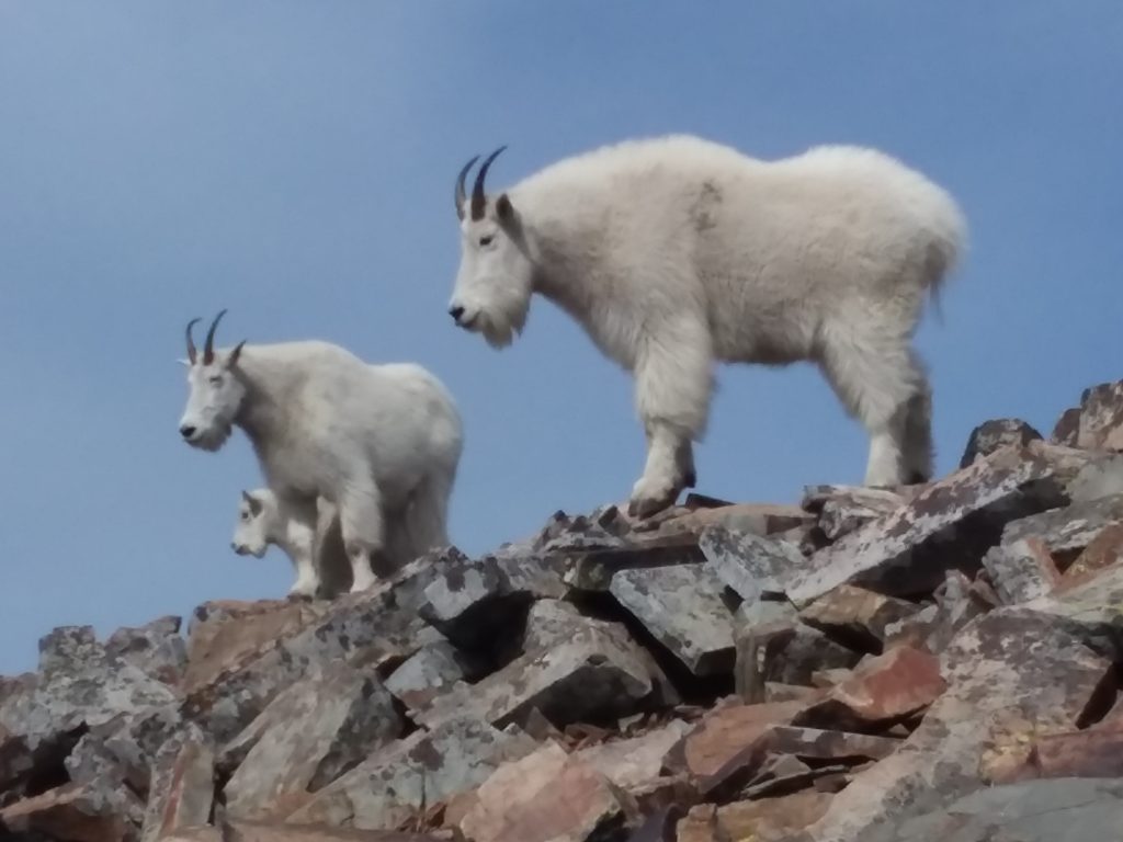
Ok, now along that wall is a goat trail. One that most climbers would take to stay high, not drop and lose all of that freshly gained elevation like I’m going to do.
I can almost trace the goat traverse along that wall. Yeah, my style, but not on a very long and tiring solo day. Let’s err on the side of safety this time.

A very quiet and still morning at Lake Elizabeth. The big arm of Natoas Peak and Cosley Ridge is behind it.

Can you spot the hole that marks the exit of the Ptarmigan Tunnel?

Mt Merritt is looking big and bad this morning. Nice to see Old Sun glacier still around and kicking it after 35 years. Quite a few others that can’t say the same (and are now ‘just’ snow fields). Natoas Peak proper to the right.

There we go. The full view of the hand-blasted trail going all the way up to the Belly River side of the Ptarmigan Tunnel.

Did I say I was hiding from the sun? Wonderful morning. Dead still.

Amazing to see wildflowers still blooming all the way into early August.

Up from Lake Elizabeth is her cousin: Lake Helen. Tucked way back in a classic glacial cirque. Ahern Peak to the far left. Ipasha Peak and her sheer wall towering over a waking and calm Helen Lake.

After taking three miles to lose all the elevation I climbed up to cross thru the tunnel, I begin the long long march up to Redgap Pass. It’s all new to me. Terra Incognito!!!!!

An unnamed high point along the Ptarmigan Wall. Somewhere along that ridge is the backside of the goat trail that I was going to try to find and traverse. Good call not going there.

The sun finally catches me and I start climbing up towards Redgap Pass.

What an incredible day. Merritt is still the king of the region. And one of the only six peaks in the Park in the 10k high club.

Although my map only shows it was 1200′ of gain from the trail junction down deep in the valley, it sure felt like a LOT more. But at last, I find myself at Redgap Pass. It is all downhill from here for the last 12-plus miles of the loop. Or so I thought.

You know me. Never turn down a chance to pull out the selfie stick. Especially when I am someplace totally new.
This is a really strange view to me. To the left, the smallish peak is Mt Henkel. My first climb ever in the Park from back in 1985, and the peak I have definitely climbed the most times. But I have never seen it from this angle, let alone the backside.
That is Kennedy Lake tucked up in the cirque behind it. How many times I’ve looked down on the lake from the 8870′ summit of the Big H? The massif to the left with the sheer face is Crowfeet Mtn. Looks like a bump you wouldn’t ever bother to climb from the Swiftcurrent side. Seems like I’ve got another climb to add to my list this summer.
That is why I love Glacier. When something so very old turns into something so very new and exciting.

It’s long down from Redgap Pass, and a very very long out once I reach that forested valley which is not only far below but also far away.

The upper basin provided me with lots of colorful waterfalls. This one was primarily of Grinnell argillite.

Not to be disappointed by this layered cascade that provided some nice Appekunny argillite for the water to cascade over in the early afternoon sunlight.

This trail toward Poia Lake surprised me. I was afraid it would be in a muddy and sticky valley bottom. But it stayed just high enough to provide a combination of nice forest travel that would break out into high alpine meadows.

Looking back, with Redgap Pass tucked way up to the far right. The unnamed high points of the Ptarmigan Wall fill the center of the photo.

It is all about perspective. This was a six-mile valley I was crossing thru. That’s why my feet started to hurt and the day was wearing long with the building heat.

Finally I roll up on Poia Lake. Never been here. Located mostly on the back side of the Appekunny Mtn complex.

Poia is in a awkward place, at least from a backcountry perspective. A grueling climb six miles from any trailhead, and another equally grueling six-mile climb to anywhere else deeper into the wilderness. But beautiful nevertheless (as long as you have the cartilage to burn).

Some comments.
On the long hike to the truck, I eye other climbing options. Here is a nice little ridge that will take you up to Sherburne Peak, and provide access to other high country ridge walks and traverses.

Hey! There is an old friend!! Remember my other marathon day doing that long long long ridge walk along East Flattop in quest of Napi Point? Hmmm…. I didn’t realize I lost that much gain over those high-elevation miles. That must have been why I was tired that day (along with the 13 hours on the trail).

The last couple of miles were miserable. In every sense of the word. Not only did I find out the horse concession was using those miles for horse tours (because the Cracker Lake route was too full of roaming mountain lions), but they really truly sucked. All forest with no views, plus an extra 600 feet of gain before the big drop down to the Swiftcurrent valley drainage.
But on the bright side, I was able to capture a photo of a solid trio of true old friends. To the far left is Mt Wynn. Never climbed it, but it was never worthy of my effort. At the far back of the valley (about 5 miles away) is good old Mt Siyeh.
I’ve been to the top of that 10k footer a couple of times (the last being last summer when I came across bears foraging for moths). And last but not least Mt Allen. A peak with a horrible reason for how it was named, but was a solid 9-hour round trip climb from the valley in 2004.

And here is my mileage/elevation/travel time breakdown. Even by my standards, these are pretty impressive numbers all around. If anyone told me I could grind out 25 miles in ten hours with the better part of a mile gain, I would have called them insane. But at the end of the day, it looks like I’m the crazy one. Go figure.


 Total views : 1527859


Awesome stuff!
You are a freak of nature and I mean that in a good way. Still need that DNA sample for scientific purposes.