Smoky Waters. Bleached Timbers. Moose Bone. High school bands, or my last kayak?
Origin Date: 9/5/25
Wow. Go big or go home. That’s my attitude for the last day on the water in Glacier for the 2025 season. Almost nine hours out there and nearly 17 miles. This time, I’m going to give you the Strava up front. Let’s see if I can whet the appetite for one last walk on the water side (turn up the music).
I have, for the most part, taken just about everything St Mary has thrown at me. Now I’m not saying I’ve seen it all, but I’ve seen enough to never underestimate and always respect this Maidan of the Mountains. This is forever her turf, not mine.

I want to get in some extra miles today. To really push. And the only way to do that is to see if I have enough left in the tank to head south of the boat dock put-in. That’s right, the OTHER half of the lake I’ve been blatantly ignoring the entire summer.

But today was different. I’m usually gone by Labor Day because of the start of school. This year I’m getting a little deeper into September. With the wet summer, the forest fires (and smoke) came late this year. Very late.

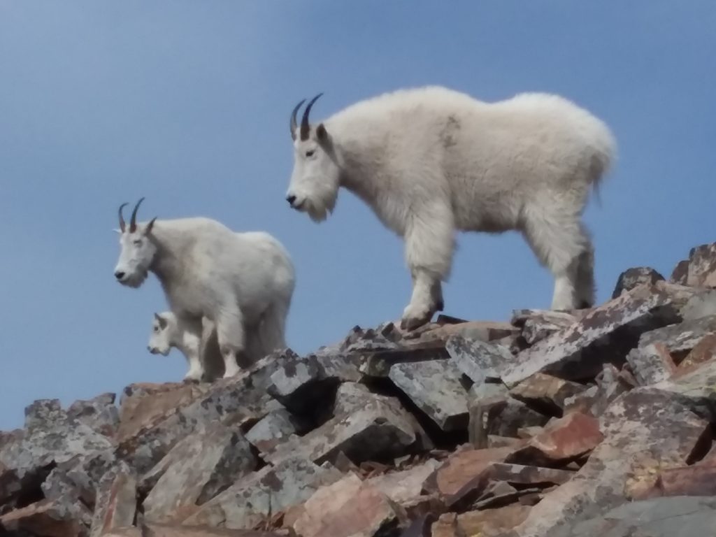
There are still plenty of bald eagles along the miles and miles of shoreline looking for a meal. Glacier Park is on the migratory path, and they take advantage of the fish in the numerous lakes.

As I follow the shoreline, constantly looking for animals (I am so spoiled from that bear encounter), I do my best to look past the haze in the sky. There is a little wind. I might get a break up lake.

Fall is clearly in the air. Much more crisp than it has been over the last couple of weeks. And the foliage is getting more gold by the day. My time here is almost done, but I feel like I’ve made the most of it.

All the beaches I’ve visited since last June are showing much more rock. Although I can tell the historical water line from the cliffs on the opposite shore, a few feet of drop makes a BIG difference on a lake this long and narrow.

The skies were looking a little better as I paddled along. The water was comfortable with just the slightest of breezes. But it didn’t matter. This is the day I’m going to push the limits.

I find myself at Sun Point again. Can even see some people walking around up there. While they are taking in that breathtaking view from that rocky promontory, I still have to wonder…..

Do they really know what a magnificent site this was for a Chalet? What an incredible place it must have been to stay over a century ago. Back when the Roaring 20s were really roaring.

I look over at what I call Hill’s island (actually a peninsula, but island sounds better). There were those two cabins Louis Hill had purpose-built as a private retreat. I even spent one paddle trying to find any remnants or a trace, with no success.

The structures up on Sun Point proper were supposedly burned with the remains bulldozed into St Mary Lake in the Spring of 1948. That’s something you could pull off on a barren rock surrounded by water. Not so much on the forest side of St Mary where the cabins were.

The waters were being kind to me today. The wonderful stark white stick forest at the mouth of Bering Creek, with Going to the Sun Mtn in the background.

The calm reflection of the Grinnell Formation, displaying those colorful layered cliffs that come to the water’s edge and steeply descend to the bottom of the lake.

It’s only been 10 years since this fire. But the soil is so poor and the climate so dry, reforestation takes a very long time. Maybe my children’s children might someday sit in the shade down at this shoreline. Maybe.

I continued my way toward the head of the lake like I always do, and things started shaping up better than I had expected. I’ve had my share of smoky days in Glacier. This one was looking to be on the mild side.

Until I look back, of course. I was drawn by the noise of a tour boat. They can only go about as far as Bering Falls. Mainly because they have a dock there, but also the lake starts to get very shallow the closer to the head and the inlet of the St Mary River.

Which is exactly where I was going. I started to drag my rudder in a couple of spots, and then I saw this. A moose shed from who knows how long ago.

I was charged by a moose not far from here. The water is less than a foot deep. I circled it a few times, wondering what the back story was. To think of this massive beast as he crossed these shallows sometime in the not-so-distant past.

With the tour boat gone, I had the lake to myself once again. It would be awhile before I’d hear the next one chugging up lake. But it didn’t matter. Because I was going into the Cone of Silence.

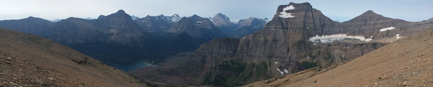
The westernmost estuary is my favorite. Farthest from the road and trail. And it always gives me perfectly framed views of the Going-to-the-Sun massif in all its glory.

And then … nothing. Dead still. The only sound was my kayak kissing the surface of the lake as I glided from vantage point to vantage point. I’ve seen all of this before. But when the water is so perfect, it feels like the first time.

As the day warmed up, I decided to do what the fish do. I hugged the shoreline to stay in the shadows of the trees. And I found out what a Belted-Kingfisher is, because they were all over. They must love this feeding zone, and squawked at me constantly for spooking off the small fish they hunt.

Looking up at distant Logan Pass from the water (and so far away). You can take in the glory of Mt Reynolds, Heavy Runner, and Clements all without being in a sea of tourists.

I pull up at the beach near Hill’s cabin site. Last time, I didn’t have any luck finding building remains. The brush was so thick, and I just had my water shoes. However, today I spot a little game trail. From the water, it appears to cut cleanly through the forest. I beach the kayak.

And follow the trail. Hmmm. Never been on this shoreline. And I see something that should not be there. Looks like … weathered wood … dimensional boards?

At last, what once was lost now is found!!! What I am looking at is the remains of BOTH of Hill’s cabins! And now everything makes sense.

The main site at Sun Point, building remains could be burned or hauled off. But here on the other side of the lake, it’s a trail-only access. It would have been expensive to drag everything out via hoof or boat. The Great Northern wasn’t throwing money around post WWII.

So why not completely dismantle both structures by hand, and pile the debris on the BACKSIDE of the build site? Out of sight of Sun Point, and out of mind as far as the NPS was concerned. Brillant.

Most of the boards still had nails in them. As if busted apart with a hammer just yesterday, and thrown in a pile. This lumber was milled in the late teens and 20s, and is still in sound shape after the first 100 years. With the dry mountain climate, how many more years until they finally rot away?

As I continue back down the lake, I take one last peek at my treasure find. I can’t believe I finally found those last remnants of the once mighty Going to the Sun Chalet Colony. Something new after forty years of coming to Glacier Park. That seems to be a recurring theme.

Hugging the shadows of the shore on a warm day was amazing. The water is so clear, I would just coast and watch all of the fish beneath me. Some would scatter, thinking I’m a sea monster. Others would drift up and peck my kayak, and then dart away. I was at one with the water.

Once last stop at Silver Dollar Beach. Oh my, how it had changed in just three short months. I think back to this shoreline being only about 3-5 feet wide.

Now it’s quite a hike up to the treeline (and some much-needed shade). I wanted to do some more exploring here, as it would be the last time for the season.

Behind the treeline is a landlocked pond. I’ve always wanted to dip the kayak in, and see what there is to see. Maybe today was the day. But…

I didn’t want to drag my inflatable overland. A lot of dead tree snags and brush. I’d be just asking for a puncture, and the patch kit was back in the van. So I will have to save that for a future visit. When the water is higher and an safer portage.

Now, how much do I have left in the tank? I paddle right past the boat dock and explore some terra incognito in the southern half of Upper St Mary lake. How the views change. The transition from the Rocky Mountains to the Great Plains is abrupt and sharp from this section of water.

The water is just flat and too good to stop. I’ve never seen East Flattop or Single-shot (Great Stone Head) mountains from this angle before. Except on the top of Divide Peak, of course. But that was looking down, not up over an expanse of water.

What do I spy in the shallow just off the shore? Milled logs? With rock backfill. Clearly something man-made, and not all that ancient in the eyes of Glacier.

It looks like cribbing I’ve seen at some trailhead for offloading livestock. But that wouldn’t make sense here.

I’m guessing an old boat dock. But on this side of the lake? And it’s still a few feet underwater, when the lake is at its lowest point in the season. Hmmmm. Some mysteries will never be solved.

Although much more subdued than the upper half of the lake, there is still that raw beauty you can only get on the East Side of the Park. I could see the early explorers, Grinnell and Appekunny, climbing up these exact hills as if it were 150 years ago.

I made it farther down the lake than I had planned. The water was keeping calm and I couldn’t help but solider on.

This was when I reached my turn around point. At the foot of the lake the water was changing, in both color and texture. I wish I would have caught a picture. It took about ten minutes before it overtook me. A afternoon 8 knot wind coming off the plains. But…. It was at my back!

Great way to end the season. Exhausted, but happy.
GoatBoy out!
And Patrick sucks. For (almost) the last time. Now I don’t even know if he’s read any of these posts. But I think his family has. They are some of my biggest fans!


 Total views : 1531768